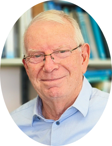
Speakers

施开放教授,安徽师范大学,中国.jpg

Prof. Kaifang Shi

Anhui Normal University, China

Shi Kaifang is a Professor and Doctoral Supervisor at Anhui Normal University. He has received the Second Prize of the Outstanding Scientific Research Achievement Award from the Ministry of Education, the First Prize of the Geographic Information Science and Technology Progress Award, the First Prize of the Anhui Provincial Teaching Achievement Award (Postgraduate Education), and the First Prize of the Anhui Provincial Teaching Achievement Award (Undergraduate Education). His research primarily focuses on nighttime light remote sensing, intelligent perception and simulation of urban socio-economic activities. In recent years, he has led or participated in over 10 projects funded by the National Natural Science Foundation of China, including Young Scientist, General, and Key programs. He has published more than 100 papers as first or corresponding author in leading domestic and international academic journals such as Nature Cities, The Innovation, and Remote Sensing of Environment.

Speech Title: Satellite remote sensing data reveal an uphill trend in global urban expansion

Abstract:Urban uphill expansion has become a widespread phenomenon, giving rise to distinctive characteristics in urban form, landscape, and governance, while also posing considerable challenges to sustainable urban development worldwide. However, few studies have examined whether global urban expansion exhibits an uphill trend. To address this gap, this study employs slope spectrum analysis based on medium- and high-resolution remote sensing imagery to derive and analyze topographic slope spectra and urban-land slope spectra across multiple scales—continental, national, and a selection of representative mountainous, hilly, and valley cities. On this basis, we assess the uphill trend of global urban expansion.


郑兴明研究员,中国科学院东北地理与农业生态研究所,中国.jpg

Prof. Zheng Xingming

Northeast Institute of Geography and Agroecology, CAS, China

Xingming Zheng, Ph.D., Research Professor, is a recipient of the Jilin Provincial Outstanding Young Scholar title and the Changbai Mountain Young Top-notch Talent title, and holds a specially-appointed core researcher position at the Chinese Academy of Sciences. His main research focuses on remote sensing experiments, remote sensing modeling and land surface parameter inversion. He has presided over more than 40 research projects, published over 100 academic papers, and obtained 20 granted patents and software copyright registrations.

Speech Title: Research Progress on Microwave Remote Sensing Retrieval of Soil Moisture

Abstract: Soil moisture is a key factor regulating water and energy exchange at the land-atmosphere interface, and has important application value in fields such as water resources management, climate change research and precision agricultural production. Current soil moisture products can hardly balance the performance in temporal, spatial and depth dimensions simultaneously, failing to fully meet the demands of refined applications. Focusing on the goal of high-precision spatial mapping of farmland soil moisture, this study elaborates technical solutions for spatial remote sensing inversion of soil moisture from multiple dimensions, including experimental data, roughness measurement and its temporal variation, row direction detection, radar filtering, vegetation interference suppression and inversion algorithm, so as to support rapid and high-precision mapping of farmland soil moisture over large areas.

王旭峰研究员,中国科学院西北生态环境资源研究院,中国.jpg

Prof. Xufeng Wang

Northwest Institute of Eco-Environment and Resources, CAS, China

Ph.D. in Science, Professor (Doctoral Supervisor) at the Northwest Institute of Eco-Environment and Resources, Chinese Academy of Sciences, and Deputy Director of the Heihe Remote Sensing Station, Chinese Academy of Sciences. Recipient of the Gansu Provincial Outstanding Youth Science Fund and a member of the Youth Innovation Promotion Association (YIPA), Chinese Academy of Sciences. Has long been engaged in research on ecological remote sensing, vegetation carbon and water flux observation and modeling, and their responses to climate change in cold and arid regions. Has published over 60 papers in top-tier journals including Nature Communications, Remote Sensing of Environment, and Earth System Science Data. Has led or completed more than 10 research projects, including the Joint Regional Key Fund of the National Natural Science Foundation of China, General Program of NSFC, Major Science and Technology Special Projects of Gansu Province, and Major Special Projects on High-Resolution Earth Observation Systems.

Speech Title: Analysis of Carbon and Water Flux Observations and Their Driving Mechanisms in the Heihe River Basin

Abstract:The eddy covariance (EC) technique is currently the most widely used method for measuring carbon exchange between terrestrial ecosystems and the atmosphere at the ecosystem scale. Using this technique, a regional carbon flux network comprising a total of 34 sites has been established in the Heihe River Basin (HRB) in Northwest China. This network has been measuring the net ecosystem exchange (NEE) of CO2 for a variety of vegetation types. In this study, we compiled and post-processed half-hourly flux data from these 34 EC flux sites in the HRB to create a continuous, homogenized time series dataset. We employed standardized processing procedures to fill data gaps in meteorological and NEE measurements at half-hourly intervals. NEE measurements were also partitioned into gross primary production (GPP) and ecosystem respiration (Reco). Furthermore, half-hourly meteorological and NEE data were aggregated to daily, weekly, monthly, and yearly timescales. As a result, we produced a continuous carbon flux and auxiliary meteorological dataset, which includes 18 sites with continuous multi-year observations and 16 sites observed only during the 2012 growing season, amounting to a total of 1,513 site-months. Using the post-processed dataset, we explored the temporal and spatial characteristics of carbon exchange in the HRB. In the diurnal variation curve, GPP, NEE, and Reco peak later for ecosystems in the artificial oasis (cropland and wetland) compared to those outside the artificial oasis (grassland, forest, woodland, and Gobi/desert). Seasonal NEE, GPP, and Reco peak in early July for grassland, forest, woodland, and cropland but remain close to zero throughout the year for gobi/desert. In the last decade, NEE of wetlands significantly increased, while NEE for other ecosystems did not exhibit significant trends. Annual NEE, GPP, and Reco are significantly higher for sites inside the artificial/natural oasis compared to those outside the oasis. This post-processed carbon flux dataset has numerous applications, including exploring the carbon exchange characteristics of alpine and arid ecosystems, analyzing ecosystem responses to climate extremes, conducting cross-site synthesis from regional to global scales, supporting regional and global upscaling studies, interpreting and calibrating remote sensing products, and evaluating and calibrating carbon cycle models.